
Beirut Urban Declaration.
bud·
“The declaration is an intellectual and cultural endeavor that contributes to the formulation of a comprehensive vision, in form of ideas and proposals of the reformation of the city.”— David AouadBrief
This investigation focuses mainly on the Study of the Urban Typo-Morphology and Connectivity of the Medawar/Karantina — Rmeil Area. The work falls under Axe3.3 of the Beirut Urban Declaration and elaborates the study of the morphology of the area and its relationship with the typology of the buildings and streets, to delve into the social and economic relationship of each neighborhood in the affected area, the neighborhoods with each other, as well as their relationship with the port. “The declaration is an intellectual and cultural endeavor that contributes to the formulation of a comprehensive vision, in form of ideas and proposals of the reformation of the city. It presents them as a set of documented issues that seek to meet the challenges of emptying the city from its residents and demography change, as well as providing suggestions and quick feasible, and operational ideas to the officials and official institutions concerned”.
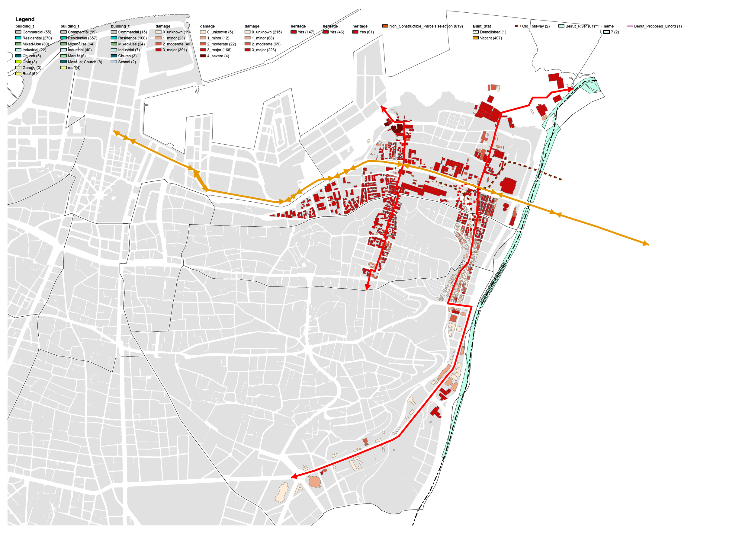
The typo-morphology of the built fabric classifies the urban elements that are integrate parts of the city. This approach is based on the recognition of existing urban forms, supplemented by existing or desired functions in the neighborhoods. The morphological studies are predominantly executed on four scales or resolutions of analysis: building/plot or lot, street/city block, city and region. An analysis grid, listing the characteristics of the urban fabric, will be developed in order to define the typologies of the urban fabric. The main criteria used to categorize the different types of urban fabrics are: a) The relationship to public space; b) the characteristics of the parcel (size, shape); c )the characteristics of the buildings (location in relation to the public / to roads and to neighbors, footprint / height, building density, etc.); and d) Its use (mono-functional or mixed).
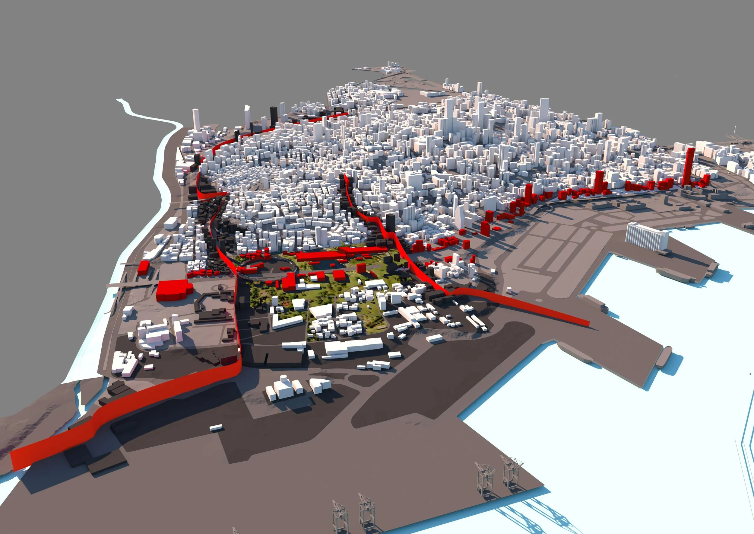
All works shown in this section are solely developed by Aouad and DAJH Architects for the Beirut Urban Declaration Conference on April 10-11, 2021.
Establish a common platform
Through the reactivation of vacant lots and non-constructible parcels through connected paths and the re-use of heritage buildings. It was shown that a high number of unbuilt vacant lots (23.7% of the total parcels area) are present within the urban fabric. Non-constructible parcels (3.16% of the total parcels area) are small area parcels (less than 200 Sq.M) and create certain gaps in the urban fabric. Most of the time they are derelict spaces, private or public, used mostly as parking lots and generator platforms. Those lots should be integrating within the mobility plan and should play an important role in connecting different ends of the area to the proposed urban park. This fabric was severely damages after the August 4th blast; and a strategy for the re-use of existing industrial amenities, heritage buildings and residential buildings in decay needs to be developed.
Decaying streets reactivation
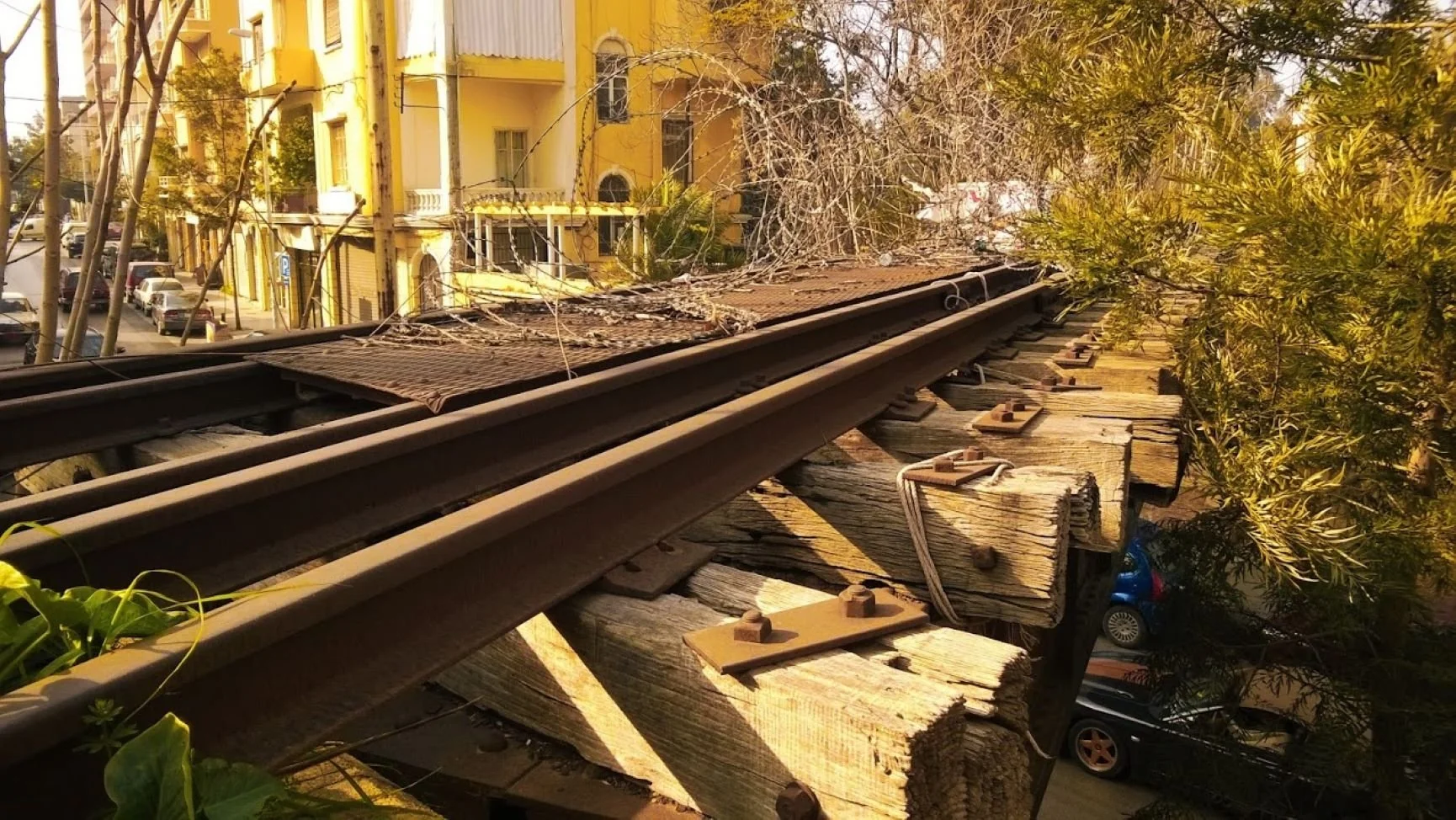
As far as 1936, Ibrahim Bacha and El-Khodr streets were stretching all the way to the port (Ibrahim Bacha is seen on maps dating back to 1876). The Charles Helou Avenue broke that connection. Today these areas are witnessing high level of gentrification due to the growing urban developments, we propose to reconnect those two ends of the streets which will help reactivate them and create seamless connections and mobility form the Southern end to the Northern end of the area. Since its introduction in 1958, the Charles Helou isolated Medawar/Karantina area from the rest of the city. It is worth investigating different scenarios for the future planning of the highway and considering the long forgotten Linord project that proposed an alternative route inside Karantina, which could ease up traffic from the highway hence re-establishing this main entrance to Beirut as a major urban gate.
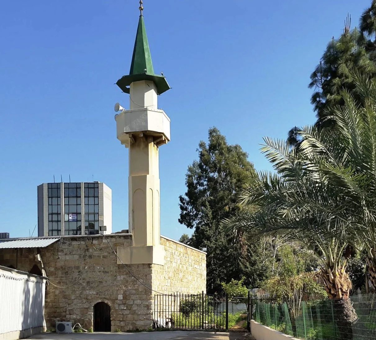
El-Khodr mosque boundary
The El-Khodr Mosque dates from around 1664 and is located today at the edge of the highway along El-Khodr street. With time, some unfortunate additions were made to this valuable religious building and other structures were implemented next to it. We propose to revert back to the 1915 situation where the Mosque was exposed from all sides, abiding simultaneously to the 2009 NPMPLT directives in regards to landmark buildings. By redefining the boundaries of this Mosque, this allows for a clear understanding of the open space surrounding it, creating public piazza connected to the station and to the southern entrance from Armenia street. Moreover, and according to the 2009 NPMPLT, the local urban plans should identify protection perimeters around these sites and define valorization methods adapted to the situation of every site and endowed with adequate valorization regulations.


Sources
OEA (Order of Engineers and Architects, Beirut),
BBED (Beirut Built Environment Database),
LRC (Lebanese Red Cross),
FER (Beirut Forward Emergency Room by the Lebanese Army).
Base 3D model from forensic-architecture.org